Location is everything. Of the 3.5 million people who visit Grand Teton National Park each year, less than 1% get a mile from the road and only about 0.1% of that 1% venture further into the high country, either to climb a relatively tiny fraction of the 130 peaks in the range, or hike the 200+ miles of trail. By their nature the Tetons are a hostile environment so there is a degree of natural containment that keeps the adventurous few to a cozy few of the park's 310,000 acres. Wander above 10,000 feet in the right places at the right time and you can go days without seeing another person. The "Walk In The Park", in this case, a north-to-south stroll along the 60-some mile length of the range, has many variations. The northern half is mostly trailless. You can do it in a couple of days or in a week. It has been done in each of the four seasons. By the main track, it covers about 95 kilometers. It keeps as close to, or just east of the park boundary - which is the hydrographic divide - as is practical and prudent, sticking mostly to third class ground, bagging a few peaks, and dropping down occasionally for water and camping. It is a walk in the park, but not in the casual sense. There are sections of the main track that are isolated, tedious and demanding.
Choices, Choices, Choices. Most of my trips were as a National Park Service employee, so I favored a boat shuttle from Colter Bay to the outlet of Berry Creek near the north end of Jackson Lake. Wading can be an option if the lake is low. The start from Jackson Lake makes for a very pleasant day to Upper Berry via either the Glade Creek-Berry Creek trail or the Owl Creek Cutoff. It is possible to start at the Glade Creek Trailhead on the Grassy Lake Road, or from Idaho at Coyote Meadows, then up South Bitch Creek and Camp Lake to reach the divide. You can also follow a lesser-developed system of trails from the Lake of the Woods on the Grassy Lake Road around the head of Boone Creek to Survey Peak and from there, follow the northern-most section of the divide to points south. This area of the park is prime grizzly bear habitat and firearms are prohibited. An encounter, or at least a siting - even in the higher elevations - is a distinct possibility. There is no room here for all the bear stories that have their roots in this area, but it's worth noting that spray does work - really well...
Once on the divide, which defines the west boundary of the park, you can remain above 2500 meters for 50 kilometers or more. From the northern end of the range, you can follow it with minor detours over Survey Peak, Jackass Pass, Conant Pass, Red Mountain and Peak 10,422 (bighorn sheep) overlooking Moose Basin Divide, then over Moose Mountain and down to Horsethief Pass at the head of Moose Basin. Another kilometer south and you abruptly leave the dolomitic sediments and enter the crystalline rocks of the central section of the range. If you have started from Bitch Creek and Camp Lake, you will intersect the divide just a bit south of this area. The main route leaves the divide here and drops into the basin east of Glacier Peak before climbing to col 10,400 overlooking Snowshoe Canyon. Yielding, then regaining the 700 meters necessary to traverse the head of this double-barrelled canyon to reach col 10,460 on its southern rim is not trivial.
The alternative that stays on the divide is difficult and committing. Glacier Peak is the first major summit at 3332 meters, though on the topo it is designated merely as a survey point. From the summit, clever routefinding and a bit of 4th class scrambling over the next 4 kilometers will take you past Blackwelder Point (another surveyor) and on to Peak 10,852, also known as Doubtful Peak. From here you can see much of the route flanking Moran Canyon southward to Littles Peak. The ridgecrest to the west is festooned with small towers and is most easily bypassed across slopes to the south, eventually gaining Point 10,474. It is then easy walking along the crest west to Dry Ridge Mtn. Otherwise a descent to Lake 9610 is possible to the southeast via 3rd class slabs and chimneys to Col 10,460 where you rejoin the main route.
From Col. 10,460, descend scree slopes to the west for about 300 meters before turning south to the lake. From here, you can climb back up to the divide, or continue along the main route which makes a long, gently descending traverse into the head of the north fork of Moran Canyon before climbing southward up terraces to Lake 9,660 (Amazing Lake) below Peak 10,484.
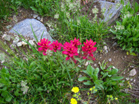 Rosy Paintbrush
If you kept to the divide, you can stay on, or near the ridgecrest past Green Lakes Mountain all the way to a sub-summit of Peak 10,484 which overlooks the Green Lake basin to the southwest and Cleaver and Maidenform Peaks immediately to the east. Avoid the questionable ridgecrest south of this summit and descend easterly on easy slopes to the divide between the lakes. To the north is Amazing Lake. If you followed the main route to Amazing Lake, this divide is due south. Benches above the smaller lake to the south have good campsites. To continue from this divide, round the outlet of the southern (warmer) lake and wander up the ridge that leads to the southern sub-summit of Peak 10,484.
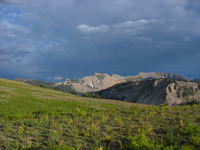
 Cruising Ahead
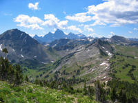
The next three kilometers along the west flank of the divide to the base of Littles Peak is through meadows often filled with wildflowers in early August. The ridge between Moran and Leigh Canyons gives easy access to Maidenform Peak and one of the most comprehensive views of the range. There is also a good, but usually dry campsite near the low point of this ridge, but be prepared - it is a thoroughfare for wildlife passing between canyons. The route from the Leigh Creek divide up Littles Peak is drudgery, but the view from this 3265 meter summit is worthwhile and is a good vantage point for the route ahead that follows the high plateau overlooking the north fork of Cascade Canyon.
The descent from Littles Peak to the east is mellow. Keep to the short ridgecrest before turning southward. Here you may recognize remnants of the reddish Flathead formation that signaled the beginning of the crystalline rocks north of Glacier Peak. From this area, it is possible to continue eastward and descend into the north fork of Cascade Canyon. As you head south, stay left along these next few kilometers to Point 10,855. South are the Wigwams. Traversing further is not recommended, so wander to the top of this point then descend the ridge for about 50 meters over shards of loose quartz monzanite and continue east to a small saddle - far enough to skirt the cliff band below. Pick your way down through more nasty rock to the glacial bench between to two lakes in this tiny basin. Beyond a doubt, these slabs offer one of the best campsite in the range, if not the world, or perhaps even the universe. The view? Well - don't fall off the edge while you are admiring it. One note of caution: anchor your tent and gear well, as the wind can be sudden and fierce, and anything that blows away will be hard to retrieve from the lake below.
Most of the few who do this walk are funnelled through this spot by the terrain. Occasionally, someone leaves a few rocks piled in such a way that jar your now finely-honed, hard-earned and fragile sense of solitude. Perhaps everything was perfect, and only this little arrangement of stones took the edge off the moment. People have killed for reasons a lot less noble than leaving no trace. Continue from this campsite to the east and down along often wet slabs to the lower lake. Ascend the snow-filled basin to the south until you can cut back and up to the obvious, higher notch in the ridge. The route to Table Mountain can be seen in detail from here. The Wigwams serve up even nastier rock in the steep gully below. Descend about half way while staying left before picking your way down and right through the unstable talus. Watch for glacier lilies on the descent to Alpha Lake. Cross the outlet and climb the small hill to the saddle then traverse westward into the cirque above Omega Lake. Climate change, sediments and eutrophication have reduced this once vibrant lake to little more than a pond surrounded by mud flats.
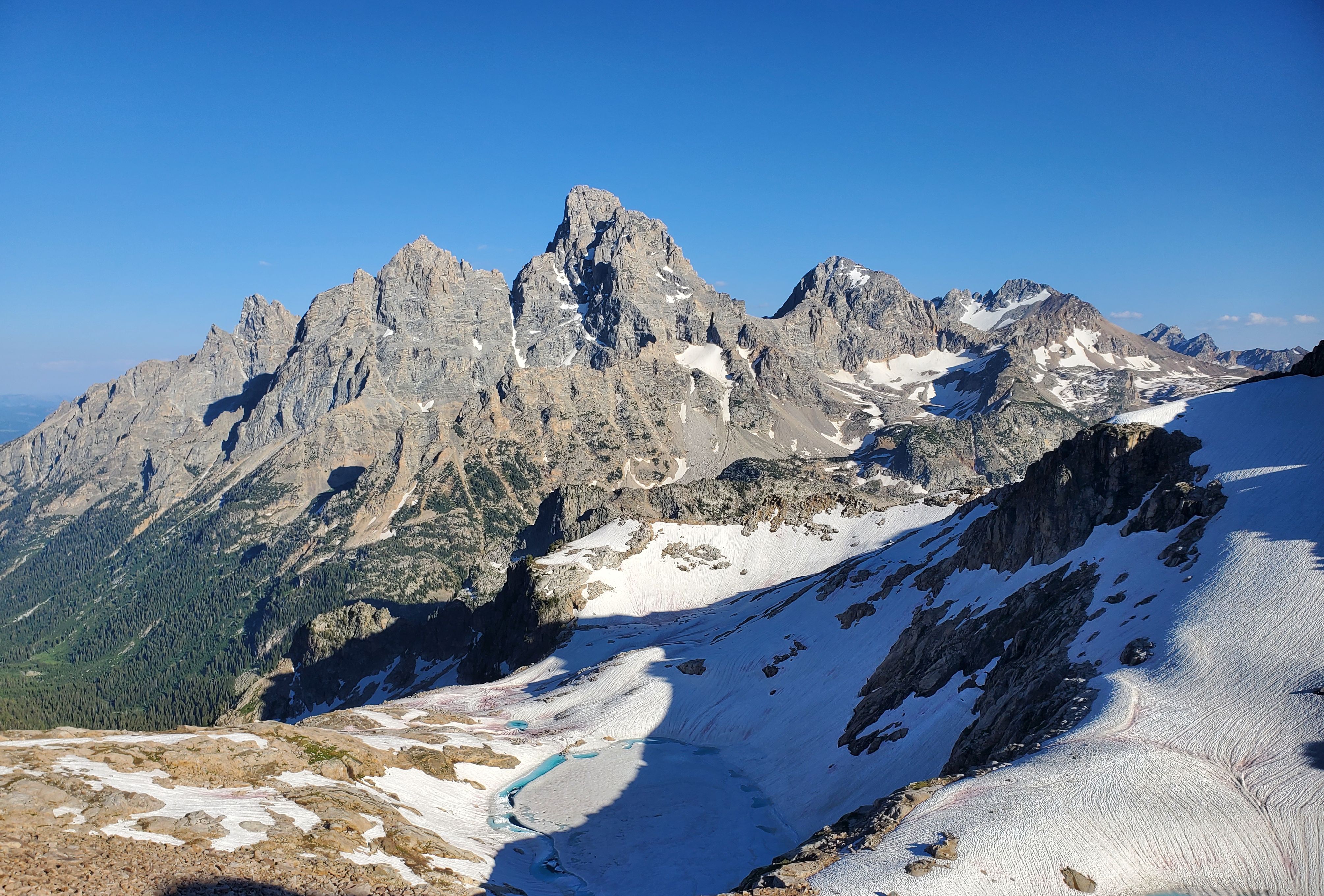
Gain the ridgecrest to the south then follow slabs that morph into a trail leading to the broad skirt of the summit block. Contour around the west flank of the peak. The view from the top of Table Mountain is stunning. On the map, the descent follows the jumbled south ridge of boulders and krumholtz to the divide at 10,120 feet between the Roaring Fork of Teton Canyon and the South Fork of Cascade Canyon. However, if you descend the main thoroughofare west for about 200 meters or so, you can then swing down to the south and east across steep easier slopes then up a little to reach the Roaring Fork Divide. If you're looking to camp, there's a good site on a bench on the park side, about 75 meters below with water nearby. From this little divide, a path climbs gently to the southwest around a small hill then along the west flank of Peak 10,635 through a limestone maze, rejoining the Crest Trail just below Hurricane Pass.
If it's summer and you've been lonely, your luck is about to change. Hurricane Pass, at 10,340 feet is on the Teton Crest Trail, the most heavily-traveled thoroughfare in the park. You can make an effort to remain lonesome by staying east and walking along the top of the "Wall", a named feature on park maps that overlooks Avalanche Canyon, but you'll eventually be forced back onto the Crest Trail somewhere above Sunset Lake. At this point however, its nice just to cruise this fine trail, enjoy its fine views and test the waters of sociability. Alaska Basin is the last of the granitic rock on this journey and filled with glacial slabs and surprising warmish ponds. A little effort can yield fine campsites, especially on the southern fringes of this huge bowl. Climbing the Sheep Steps out of the basin puts you back into sedimentary rock for the remainder of the walk. The 4+ mile walk along the Death Canyon Shelf from Mt Meek Divide to Fox Creek Pass is spectacular and unique, both a compliment and a contrast to the views of the past days. Near the group campsite, there is a break in the cliffs that lead up through 4th class ground and back onto the divide. If you choose this variation, circle well around Fossil mountain at the southern edge before descending to Fox Creek Pass. At Fox Creek Pass, the divide takes a jog to the east and again, offers an alternative to the Crest Trail, rejoining it just above Marion Lake.
 Rendezvous Peak
From Marion Lake the Crest Trail descends and climbs repeatedly across the upper reaches of the north, middle, and south forks of Granite Canyon, eventually reaching the park boundary at the head of Moose Creek. From a junction in the south fork you can follow the Rendezvous Mtn. trail to the top of the tram and ride it down (still free) or continue south to the divide, and drop into Moose Creek a bit before following the long traverse around Rendezvous Mountain to Phillips Pass and the last 8 kilometers to the trailhead at Highway 22.
You can make this nice walk even nicer via any or all of three alternatives. The first starts at the south side of Marion Lake. Head west along the flat ridge just after crossing the first small stream south of the lake and make an ascending traverse left up steep scree and grass out of the bowl to the small lake below Housetop Mtn. You can climb the small peak due west to regain the divide and walk it south to Moose Creek Divide or follow the bench to the east to avoid some scrambling, in either case, crossing the Game Creek Trail about half way to Moose Creek. Once at the head of Moose Creek, you are presented with the second option. It climbs southeast along the boundary through forests and meadows to the northeast slopes of Rendezvous Peak then west along the summit ridge until it is possible to turn south and regain the trail at Phillips Pass. With about the same vertical differential, it's a great alternative to the deep drop into, and subsequent climb out of Moose Creek that the crest trail requires. The third option starts at Phillips Pass and follows the ridgecrest, first west then south along the Bridger-Teton NF/Jedediah Smith Wilderness boundary to the top of Mt. Glory. The views of Jackson Hole and the Snake River Range to the south from the top of Glory are superlative and the wildflowers often spectacular. To the north, many of the past days' high points are visible - stacked one behind the other. The last mile of very steep trail (1655 feet descent in one mile) deposits you at Teton Pass and the highway. This could be it, but if you're still looking for a bit more walking, take the History Trail, Black Canyon Trail or the Old Pass Road to the parking lot at the bottom of the pass. Still not done? Walk down to Wilson on the bike path, take the tunnel and polish things off with a beer and burger at the Stagecoach.
The GPS tracks are approximations derived largely from memory of trips in the tech-free days of long ago, so a map is indispensible. If your intent is to keep close to, or on the divide, you will encounter exposed 4th class scrambling and downclimbing. Afternoon electrical storms can develop in a matter of minutes, so factor this into travel along ridgetops where descent to a safe zone can be difficult. Consider that more people have been killed or injured in attempts to escape lightning than from actually being electrocuted. The section from Glacier Peak and over Doubtful Peak (Peak 10,852 at the head of Snowshoe Canyon) requires committment and careful routfinding. The sections around Peak 10,484 and the Wigwams are steep and and rotten. A short length of cord is useful here and there for lowering your pack. If you find yourself otherwise needing a rope, you are probably off-route or over your head. Use has increased in the areas between Peak 10,484 and Littles Peak in recent years, so escaping detection is questionable (though the walking remains delightful nonetheless). Avoid disturbing bighorn sheep and remember that almost all critters are rearing their young and can thus be agressive. Finally, be prepared for bear encounters at any elevation where there is vegetation, and in scree and talus slopes where moths are a rich summer food source. They also seem fond of playing on snowfields and you may see tracks as an indication of this activity. The best defense is to make noise, especially when traveling through dense cover or along streams. Expect surprises and always carry bear spray where you can deploy it within a second (or two) - not in your pack. And remember, just because you read this on the internet does not mean it's your cup of tea. Don't make extra work for the rangers. Enjoy your walk in the park.
 ;
;