30 July, 2024
"Making the Oslo connection will be close" said the agent upon taking my checked bag containing trekking poles, tent stakes and a pocket knife - dangerous stuff. "Getting your bag on it will be even closer", he added. Eighteen hours later, I found myself racing through the endless concourse D of Amsterdam's Schipol airport for the must-catch flight to Oslo. "Close" was closer than I thought. Upon arriving, it soon became apparent that my bag hadn't. I took my designated place in the queue for the baggage service desk and after a bit of confoundingly simple math, determined it would be tomorrow before I reached the front of the line. I had a couple of hours to make my bus connection from Oslo to the beginning of my 7-day walk in Jotunheimen, so I caught the train into the city, found some poles and a pocket knife (how else could one cut cheese?) at a sport shop near the gigantic "Oslo bussterminal" and made my way to the designated bus bay. I congratulated myself for booking the trip through an agency as the driver greeted me with my orientation package, vouchers, map, and waxed cotton food wrap. This last item would be key in my quest for social acceptability among the vocal segment of eco-maniacal walkers.
 The Big Suck
Jotunheimen translates to "Home of the Giants" and is Norway's premier national park. It takes about 5 hours to cover the 225 kilometers north along the E16 from Oslo to the lodge at Gjendesheim. The final 50 kilometers climb out of the forested countryside and up onto the edge of the tundra. At 63° N. (the same latitude as Alaska's Denali), this remarkable change occurs about a 1000 meters above sea level. The lodge is situated on the edge of the park at the outlet of Gjende, a 25 kilometer-long, picture book glacial lake, and is the focal point for hiking in JNP. My frolic would start and end here with comfy lodging, meals and beer at the end of each day. Jotunheimen in August is by no means a backpacker's paradise; these warm, sunny days briefly belying the usual cool and rainy weather that marks the long slide into winter. This first week of August simply aligned with three to follow in Italy, in all, making the journey worth the expense and my contribution of 1.7 metric tons of CO2 to the atmosphere. The terrain is vast and, some would say, featureless, although I would counter that this really depends upon your senses of proportion and solitude. In both respects I would find myself cross-eyed with delight.
 Høgruta
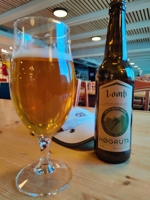
I was welcomed at the desk by a young Dane with the same surname as mine on her badge, given the key to my room, supplied with two bottles of Høgruta and directed to the great room with its fireplace. The place was filled with people so I took a place on the floor, too near the fire, and at the foot of shelves filled with Norwegian picture books and novels, and by the second beer, realized getting myself and my pack to my room might be the biggest challenge of this 48-hour day! This turned out to be simple. Gjendesheim purred with Norwegian efficiency in getting drunken, jet-lagged, semiconscious tourists to their rooms. A shower and 45-minute nap boosted my prospects of making it through dinner. The dining room was filled with a mix of Norwegians, Germans, Dutch, and a few Americans. I pigeon-holed them: The Norwegians seemed casual, the Germans organized, the Dutch laid back, and the Americans disoriented. I was seated at a table with a couple from South Africa and a young woman who I recognized from the bus. She was from Germany and had been on the same flight from Amsterdam. She confirmed my suspicion that Amsterdam was a black hole for her baggage too, so we commiserated. I was in good company but declined the invitation to walk together; appreciating all too well the 50-year difference in age. Each lodge would have a standard rap: the hosts took the opportunity to thank us, introduce their section of the park and its history, finishing with an overview of the coming day's walk - and a weather forecast.
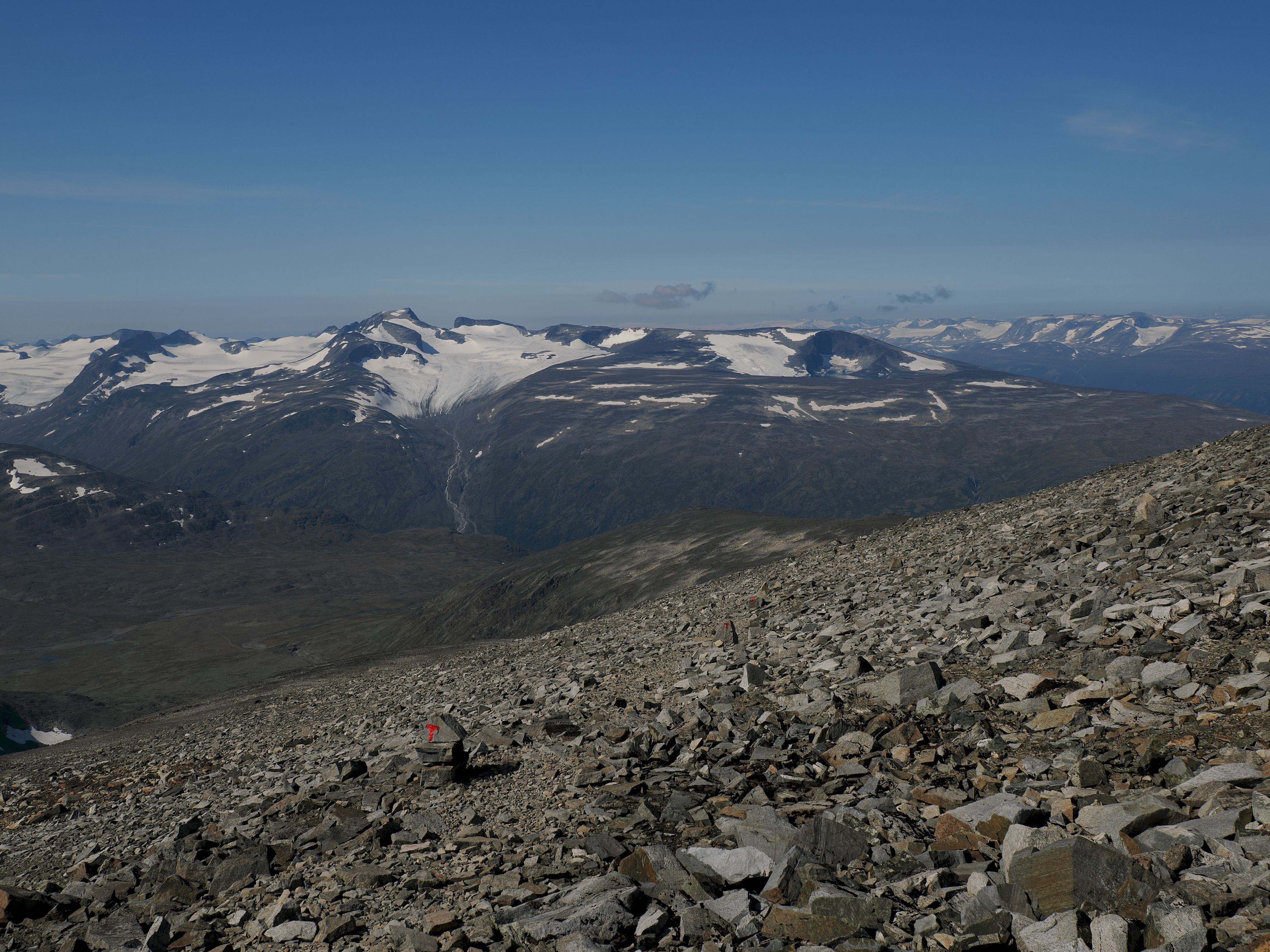
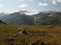
In contrast with the huts in Switzerland, France and Italy, the Norwegian lodges include lunch - which you assemble immediately after breakfast (frokost). This is a good thing since there are no facilities within the park itself - Glitterheim being the only notable exception. I received approving smiles from the other "waxies" as I wrapped my cheese and bread in the waxed cotton. I wondered if I might eventually become acccepted and privy to a secret sign or handshake. The first day's walk was the longest of the circuit - about 21 kilometers to the hut at Glitterheim. It began with a 300 meter climb out of the birches at the lake then along the shoulder of Veslfjellet. The trail was well marked with the now familiar T and the weather was perfect. There were tantalyzing glimpes of the terrain ahead but the shoulder of the 1800 meter Bessfjellet hid the first real views of the day. Delayed by photomania, I made slow progress rounding the Bessfjellet. "Bis später", said the German girl as she blazed by. "Aloha", I returned, as the views into the Russa river valley brought me to a complete standstill. Here was a world of stone and water, immense lake-filled valleys and granite domes rising a thousand meters to peek through the scree and talus heaped around them. Bigger than the Wind Rivers and smaller than northern Alaska, and lacking both bugs and bears, it was a place to forget time. From here, the road to the east was hidden and but for the lone fishing shack on the lakeshore, it appeared timeless.
 Russvatnet
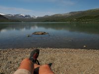
I reached the outlet
of the Russvatnet and found a small beach where I sat and ate my lunch. The water was very cold and tinted an ephemral pastel green from glacial silt. The sun was warm. I was in no hurry to leave. Eventually the damp sand doused my hypnosis. I crossed the Russa and continued along the shore of the lake, then climbed to the broad pass between the Russa and Veo river valleys (Dalens) at 1685 meters. Now in full view, I was gaining appreciation for the super-sized cirques and glacial plateaus of the Jotunheimen. The trail descended another 7 km along a gentle drainage to the lodge at Glitterheim. I was greeted by a young boy who checked me in, told me that dinner was in one-half hour, and passed along to his older brother my request for a beer. This being the only facility lying within the park, the rules preventing the corruption of minors seemed to be strictly observed.
Today's walk would include a 1400 meter ascent of Glittertinden, Norway's second highest peak. A lower, more circuitous alternative, gaining just 400 meters around the peak's southern flank only attracted a fraction of the twenty or so folks headed to Spiterstulen. It was after all, another spectacular day and Glittertinden was said to have one of the best views in the Jotunheimen. Happiness was rubbing off on everyone as they charged the path that went straight up the severely foreshortened slope. After an hour for some, the lodge wasn't getting any smaller, nor the summit any nearer, and they stopped or turned back. This nearly 8-kilometer climb, though not steep, was over scree and slow going. Known locally as the "Glittergrind", it was a true taste of Jotunheimen's deceptive vastness. The rest of the walkers found their own reason for continuing. I was simply happy to be moving.
The panorama to the south changed little over the next hour, but upon gaining the crest of the broad ridge, there were views across the three vast glaciers shrouding the peak's northern flanks. Here the cirques had bitten deep into the granite on both sides of the summit ridge, and once there, I timidly approached the rotten, overhanging crest close enough to peer down into the heart-skipping chasm.
After an hour of gaping, I began the 1500 meter descent to Spiterstulen, decidely steeper and more convoluted than the ascent. Unlike Glitterheim, one could get a ride to Spiterstulen, and I thought this explained the higher numbers of people climbing the route from there. The best - 300 meters of steep switchbacks stacked atop one another - was saved for last. Another two hours of descent brought me to the Spiterstulen just as afternoon shadows were filling the narrow valley. The lodge was filled with Norwegians, many of them families with small children, and I wondered if this was a popular destination for them. It seemed like a great place to introduce kids to the mountains.
 Galdhøpiggen
"It will build character", a fellow ranger once said, in an attempt to soften the misery of working rainy days in the mountains. Today would certainly be a candidate for it was socked-in. Others were preparing to make the climb, donning slickers and ponchos. Compelled to find out for myself, I packed up and followed a group who seemed to know the way. Besides, there were probably a thousand T's along the path to the summit. As I climbed the indistict rocky path, I realized why there were so many markers: the fog was dense enough to make the 20-meter interval through the featureless landscape of stones a neccessity. I wondered about the color-blind, for whom these T's were simply another shade of grey. What could go wrong ...? If you have come 8000 kilometers with the romantic notion of climbing the highest point in Norway, the lack of visibility will not be an acceptable excuse for bailing-out. There was really little to be said about the day's journey to nowhere and back. After the initial 200 meters of steep, the path wandered up gentler slopes. It did not rain and it was not windy, but the mist saturated everything. It was a day of both physical and sensory isolation - and strangely enjoyable. I cannot say whether it built any character - if so, I did not notice...
Today would be a piece of cake compared to the preceeding three - the distance and vertical were beginning to add up. There was only a few hundred meters of elevation gain, and the weather was forecast to improve. The way followed the Visa River valley (Visdalen), and for a couple of kilometers, it was very foggy. I was lost in the simple act of puddle-jumping when an opening appeared in the clouds, revealing a sunlit glacier at the head of a side valley and almost on cue, I heard someone singing. Near the river below was a tent catching a sunbeam and nearby - bared to the waist - the happy occupant. Whether he saw my thumbs-up or not, he continued to belt out his catchy melody until I was out of earshot. About a kilometer further up the valley was the faint path to the terminus of Vestre Memurubrean and its large complex of icefields. It would add 7 kilometers to the nearly 15 remaining to Leirvassbu but there were scattered patches of sunshine showing through. Though the walking was as pleasant as Jotenheimen could offer, the valley bottom narrowed and the walls steepened dramatically as I neared the ice field. There was only the torrent to be seen from the end of the trail, so I scrambled a couple of hundred meters up the steep slope of Memurutinden for a view across the ice. There were enough scattered patches of light breaking through the overcast to illuminate the dreamy panorama. I thought about the trail continuing south to Storådalen from the head of this benign icefield, but it would put me closer to tomorrow's destination than today's. There was a lot of country off the beaten path - all you needed to explore it was a tent. I returned to the main trail and continued on, encouraged by a clearing sky and enchanting views. Ahead was the climb to the divide - the only substantial slope of the day - disguised between the 100-meter contours on the map. Following was a level stretch and a series of small cirques, each with a tarn, and I was struck with the similarity to the Wind River Range of home. I came upon a fisherman, the first person since the happy camper. We nodded hello and as I passed I saw he had 3 or 4 small browns on a line in the water. Add a rod to the tent I thought, and one could wander all summer - another similarity to home. I rounded a corner and Leirvassbu came into view. It was a large, modern complex served by a road from Lom. I would have to give it four stars and at the door, I again had to shift mental gears after spending the day in solitude. My bag was waiting for me, and in 20 minutes I had showered and was in the bar with an endless supply of Høgruta and a bag of chips. Soft jazz was in the air and the two women I had met on Galdhøpiggen were there as well. Anne, from Luxembourg, was finished and headed to Lom the next morning. Lei, from China would continue to Gjendebu. Both had careers and professed to envy my freedom which I joked carried the risk of irrelevance and disengagement. "Are you are disengaged and irrelevant?", Lei asked seriously - "You sound fine." She was in love with her pedal-to-the-metal job of pumping people up at Microsoft. I reminded her that she was off-the-clock and countered her concern for my mental health with the premise that life was a bird cage with an open door; being a prisoner was a choice - and though escape required courage, freedom was the reward.
Dinner was grand. I was seated at my own table and the two offerings were enticing enough that I entertained fantasies of having both, but chose chicken, the first I had seen of it here - likely because Lom was a center for poultry farming and close by. There were fresh vegetables rather than the now all-too-familiar potatoes. By the time I was finished and had sampled the akvavit, I was sated - and ready for bed.
The breakfast buffet was as awesome as dinner. There weren't many guests for the early seating so I again had the privacy of my own table and a bewildering choice of pastries, breads, cheeses, meats, and fresh fruit. I was tempted to dally in the comfort of my own table, but I had a long day ahead. I was the first one out the door and it was a bit of a shock to step from the warmth of the lodge into the cold, overcast morning - not a promising start to the day.
 Øvre Høgvegltjønnen
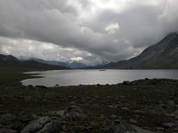
Leirvassbu is nestled next to the park boundary so after only a few minutes of walking, I entered the wild valley of Storådalen which I would follow for nearly 20 kilometers to Gjendebu. The temperature had dropped overnight with the approaching cold front and it was dismal walking for the first hour or so. Along the way, I found a baseball cap, then a glove, and a bit later, its second. After half an hour, I came upon a couple huddled beneath a rock next to the lakeshore. They had spent the night in a dilapidated fishing hut, and were reexamining their plan to walk to Gjendebu, still 15 km down valley. We made some tea. I suggested they walk the hour or so back to Leirvasbu and regroup. They were from San Diego - and on the second day of their first backpacking adventure. As I walked on, I tried to remember the first time I was cold, wet and hungry in the mountains - and when I actually learned not to be. These seemed like they should qualify as life-changing events that one should not forget - yet I had ...
 Spiterstulen Connection
I was not expecting the rapid clearing
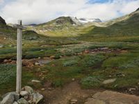
that took place an hour later, revealing peaks bounding the valley as well as those towering almost 1500 meters above Gjende, still some 10 kilometers distant. Lower in elevation than the Veo and Visa valleys, there were grasses and wildflowers blooming in this part of Storådalen. It had suddenly become a beautiful day, suggesting that here, mountain weather forecasts are as capricious for the Norwegians as they are for everyone else. As I passed the junction of the trail coming from the icefield I had visited two days ago, I thought I saw a tiny figure descending the path and wondered if it had made the passage from Spiterstulen. I crossed a large meadow and could hear the sound of rushing water - its source a waterfall that dropped some 100 meters over a headwall into the valley below. It was the first such feature I had seen in the park. It was now warm and sunny - and time for lunch. As I continued, the sound of water was replaced by that of the rustle of the leaves of the birch forest, then after a while, by the lowing of cattle. Jotenheimen, like many protected places, was a child born of compromise between conservation and consumption. Even our national parks, the crown jewels of conservation, are not immune from the demands of civilization.
 Gjendebu
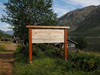
The last hill dropped to the lakeshore and Gjendebu.
The sign at the door answered all the eternal questions: "No Wifi, No Cell Service, No Problem". I checked in, received my bedding and a couple of beers, and found a spot at a table in the afternoon sun. "You American?", a woman asked. "Do I look American?", I asked in return, not quite ready for questioning. "That's an American pack.", she affirmed. "It's made in Mexico.", I added - wishing I hadn't. She shrugged and seemed to be weighing whether I was worth a debate, then sat down with her beer. "What brings you here?", she asked. "Walking. How about you?". I would find out it was not walking ... She confessed to being a 35 year-old trauma surgeon from Seattle, two years in, and already approaching burn-out. She had taken the summer off; to recover from a bad year and to reassess her desire to patch the "fuck-ups of fuck-ups". Reassembling mangled people wasn't really that much fun. I suggested pediatrics but she didn't like children either. Talking trauma care certainly wasn't goint to get any laughs, so I asked about the mountains in Washington and this got us through a couple more beers before her partner appeared and packed her off - now with a three-beer smile. "Walking's not so bad!", I offered as I shuffled to my room for a nap. Supressing my misanthropy had been exhausting.
 Between Heaven and Earth
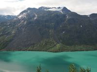
Yesterday's weather had held, but it would not last long. At least that was what was posted on the board as I paid my bill. Gjende is a deep glacial lake and the containing walls plunge directly into the water, leaving a tortuous shoreline to walk. Therefore, to get to Memurubu you climb to the plateau of the Memurutunga and follow it until dropping back down to Memurubu at the outlet of the Muru river. The alternative is to cheat and take a boat (as my pack would do), but the views from the ridge are spectacular and among the best of the entire circuit. The climb was steep enough to require an occasional stretch of cable and attention to stones whizzing by from above. By the time I reached the Memurutunga, it had become overcast with a ceiling just below the surrounding summits and the lakes had lost their magical glow. The path wandered through this immense, glaciated plateau, past glacial tarns and dizzying precipices before being squeezed back onto the ridgecrest for the steep descent to Memurubu.
A moment to mingle - or not ...
 Memerubu
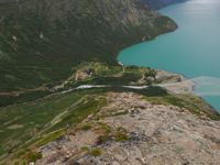
Memurubu, like Gjendebu is on the lake. Accessible to those disinclined to walk, and with 4-star amenities, it was more attractive than its humble up-lake sister - and much busier. Descending from the plateau, I watched a series of boats leave their cargo at the dock. I arrived in time to wait in the check-in queue, enjoying the scents of Chanel and Giorgio mingling with the equally-complex bouquet of the unwashed. Waffles and coffee were served as we waited. This was done equitably. I chuckled to myself with this. In contrast to Jackson Hole where the affected struggle to be dirt-bags, here the affected seemed not only comfortable with projecting superiority, but also keen for it to be acknowledged. I suppose that is the whole point - reminding us that we are civilized - or at least in the queue to become so. No dirt in these bags ... Two beers (and several waffles) later, I was in a deck chair with a second lunch in my stomach and Rickie Lee Jones in my head. The sky, now a high-latitude blue, had dissolved the morning's pessimism and my intolerance for the self-entitled. From my chair, I could not tell rich from poor. There was cell service and I thought about uploading some notes to home but fell asleep instead.
 Fun here is Fun anywhere
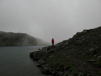
It was cloudy as I started up the path. Like yesterday, one had to go up to go down. I was well into the 400 meter climb when I met Lei. She was descending, concerned with the weather and walking solo. "You can grab a boat, or tag along if you like.", I offered, noncommittally. She shrugged and we wandered up the hill then turned east to follow the rim of cliffs along the lake. From photos, I knew this 8 kilometer stretch had the finest views of the circuit but today they would be obscured by the low cloud deck and frequent patches of dense mist that at times reduced the world to a ten-meter circle. This made for slow going through the complex, twisted terrain, yet it was intensely alluring. When it was too thick to move, we simply sat in silence, and waited for the path to show itself. Eventually, we found our way to the shore of Bessvatnet and a choice of paths. The main one followed chains back into the fog up the steep spine of the Veslfjellet. The alternative was a less-traveled one around the north shore of Bessvatnet, longer, but straightforward walking.
 Gjende
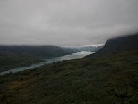
Lei was getting to know herself so I left the decision to her. After a kilometer of boulder-hopping, the chosen walk along the lakeshore became pleasant, and we followed reindeer paths through the tundra to its outlet and the final few kilometers to Gjendesheim. It had been a long, fulfilling day and the subdued view of the lake as I descended to Gjendesheim made for a perfect ending. Lei, who had gone ahead when we reached the path to Gjendesheim, was at the dock with our packs, ecstatic with her day's adventure and, I thought, showing the telltale signs of a budding dirt-bag. My work was finished. "Microsoft will be screwed without you." I suggested. We had dinner, got a little drunk, and shamelessly talked mountains. By evening's end, the CDT had become the flame and she was the moth. I wished the overachiever good luck. Tomorrow, I would find my way to far-away Italy to visit my over-achiving friends there - an adventure all its own...
Skål!
"Dawn take you all, and be stone to you!"
- Gandalf -